-
 1 × $99.00
 -
-
 1 × $119.99
 -
-

-

-
-
-
 1 × $109.95
 -
 1 × $44.99
 -

-

-
-

-
-
 1 × $479.99
 -
-
 1 × $16.00
 -
-

-
 1 × $132.12
 -
-
-
-
 1 × $563.80
 -
 2 × $19.95
 -
-
-
-
-
 1 × $146.07
 -
-
-
 1 × $232.99
 -
 1 × $1,099.00
 -
-
 1 × $24.22
 -
 1 × $694.52
 -
-
-
 1 × $35.00
 -
 1 × $2,414.99
 -
-
 1 × $60.00
 -
 1 × $119.88
 -
-
 1 × $2,717.50
 -
-

-
 1 × $499.00
 -
 1 × $655.00
 -
 1 × $5,966.00
 -

-
-
 1 × $1,493.49
 -
 1 × $563.89
 -
 1 × $329.00
 -
-
-
-
 1 × $100.00
 -
-
-
 1 × $69.99
 -

-
 1 × $35.75
 -
 1 × $23.10
 -
-
-
-
 1 × $54.99
 -

-
-
-
 1 × $23.61
 -
 1 × $280.49
 -
-
-
 1 × $299.99
 -
 1 × $70.95
 -
 1 × $69.95
 -

-
 1 × $479.99
 -
-
 1 × $24.99
 -
-
-
 1 × $24.95
 -
-
 1 × $9.75
 -
 1 × $19.95
 -

-
-
-
 1 × $34.75
 -
-
-
-
-

-
 1 × $19.99
 -
-
 1 × $4.99
 -
-
 1 × $199.00
 -
 1 × $495.00
 -
-
-
 1 × $24.99
 -
-
-
-
-
 1 × $379.99


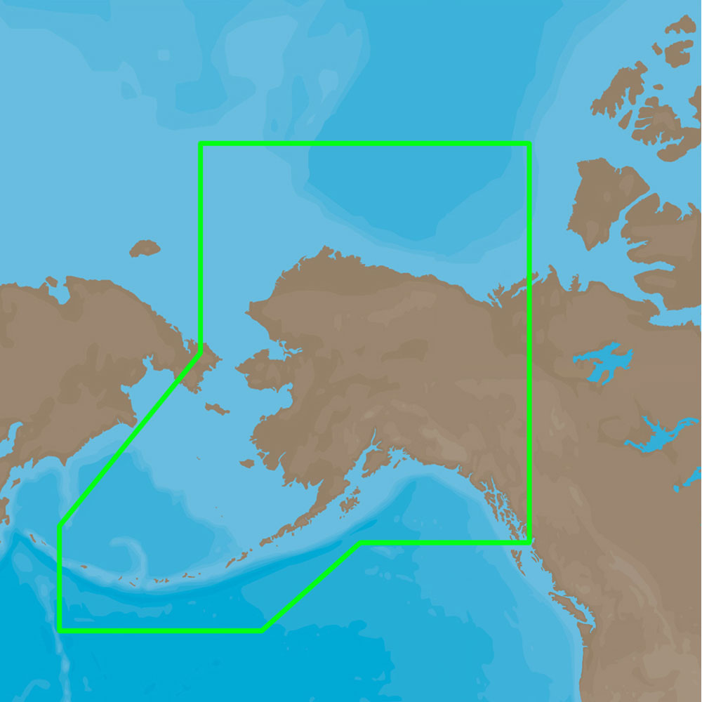
4D Lakes NA-D072 North Central
C-MAP charts have long been held in high regard by boaters because they combine aesthetically pleasing vector electronic charts with reliable sources. When buying C-MAP boaters can be assured that the charts they are getting are of the highest standard.
C-Map 4D will provide boaters with charts packed additional features such as raster chart views or Satellite images* to maximize situational awareness.
Coverage Area:
Lakes and major rivers of North Central region of USA including states of: Minnesota, Wisconsin, Michigan, Iowa, Illinois, Indiana. Includes coverage of Lake Michigan, Lake St. Clair, portions of other Great Lakes.
Additional information
| Weight | 0.2 lbs |
|---|---|
| Dimensions | 8 × 5 × 1 in |
| Brand |