
-

-
-
 1 × $20.00
 -
-
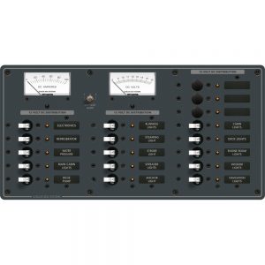
 1 × $225.00
 -
-
-
-

-
-
-
-
 1 × $18.79
 -
-
 1 × $94.99
 -

-
-
 1 × $19.95
 -
 1 × $32.99
 -
-
 1 × $24.49
 -
-
 1 × $29.95
 -
 1 × $351.16
 -

-
 1 × $155.99
 -
 1 × $20.99
 -

-
-
 1 × $1,045.85
 -
 1 × $33.00
 -
 1 × $23.58
 -
-

-
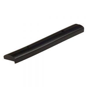
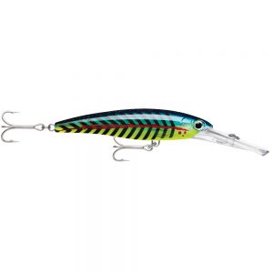
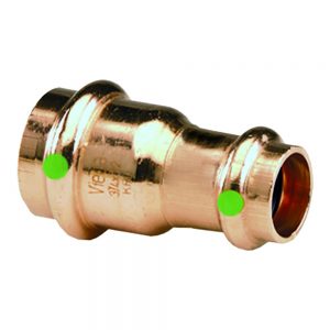
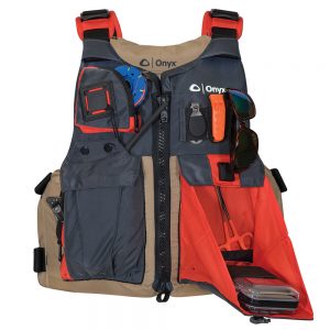
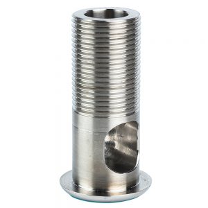
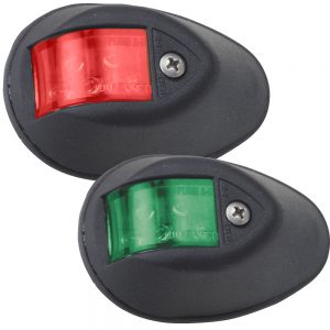
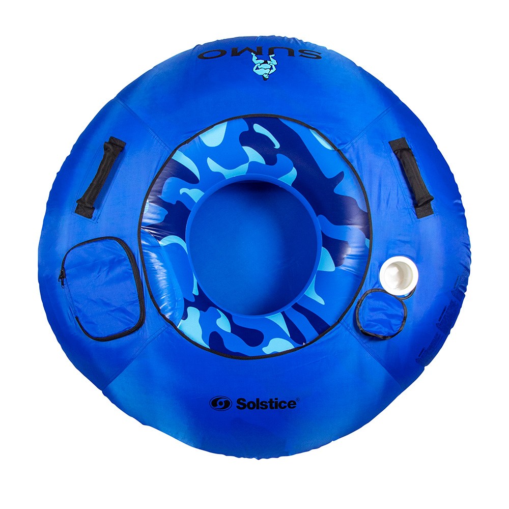
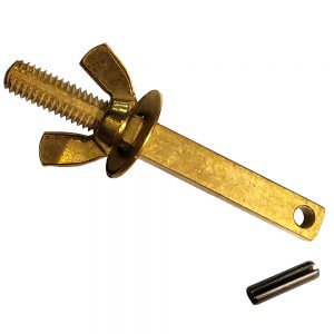
 Ocean Breeze Marine Speaker Spacer f/Wet Sounds REVO 10 HP/FA S4 - 10" Series Subwoofer - 1" - Black1 × $99.99
 -
-
-
 1 × $1,585.00
 -
-
-
-
 1 × $24.60
 -
-
-
 1 × $14.30
 -
-
 1 × $787.00
 -

-
-
-
 1 × $24.99
 -

-
 1 × $9.98
 -
-

-

-
 1 × $129.00
 -
 1 × $1,195.18
 -
-
 1 × $374.99
 -
 1 × $373.53
 -
 1 × $12.95
 -
 1 × $2,081.50
 -

-

-
-
-
 1 × $6.95
 -
 1 × $1,504.71
 -
-
 1 × $110.99
 -
 1 × $695.00
 -
 1 × $42.86
 -
-
 1 × $219.99
 -
-
 1 × $34.99
 -
-
 1 × $81.76
 -
-
 1 × $114.97
 -
-
-
-
 1 × $22.12
 -
 1 × $4,378.54
 -
-
 1 × $91.00
 -

-
 1 × $214.29
 -
 1 × $250.05
 -
 1 × $539.99
 -
-
 1 × $32.99
 -
 1 × $119.99
 -

-
-
-

-
-
-
-
-
-
-
 1 × $64.99
 -
 1 × $299.99
 -
 1 × $159.99
 -
-
 1 × $15.75
 -
 1 × $367.23
 -
 1 × $422.76
 -
-
 1 × $20.99
 -
-
 1 × $42.99
 -
-
 1 × $16.99
 -
 1 × $260.80
 -

-
-

-
 1 × $525.00
 -
-
 1 × $667.58
 -
 1 × $1,269.00
 -
 1 × $14.99
 -
 1 × $150.49
 -
 1 × $65.00
 -
 1 × $786.99
 -
-
-
 1 × $65.99
 -
-
-
 1 × $54.33
 -


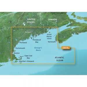
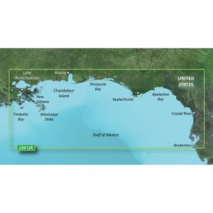
Garmin Navionics+ NSAE016R – Japan Lakes & Coastal – Marine Chart

Roll over image to zoom in
Navionics+ NSAE016R – Japan Lakes & Coastal – Marine Chart
Get the world’s No. 1 choice in the marine mapping with the best, most up-to-date Navionics®+ cartography on your compatible chartplotter.
Featuring vibrant colors, a streamlined interface and combined coastal/inland content with a popular Navionics® style color palette, Garmin Navionics+ cartography makes it easy to plot your course. Multiple shading options aid in shallow water navigation and make it easy to highlight a target depth range for the best fishing spots. Fully customizable with various chart layers, overlay combinations and up to 10 color-shaded target depth ranges to scope out the best fishing spots.
When you purchase a new Garmin Navionics+ or Garmin Navionics Vision+ cartography product, a one-year subscription is included.
Chart Code – NSAE016R
Coverage Area:
Detailed coverage of coasts of Japan: from Yaeyama Islands, Okinawa to Aniva Bay and Kunashir Island. Coastal coverage of South Korea from Busan to Deoksan-ri. Includes detailed coverage of most major lakes including Inawashiro, Kussharo, Ogawara, Onuma, Shikotsu, Shinji, Towada, and Toyako.
Features:
- All-in-one Map Solution – Access detail-rich mapping of coastal features, lakes, rivers and more. Integrated Garmin and Navionics® content offers coverage for boaters worldwide.
- Daily Chart Updates – Charts are constantly being enhanced with new and amended content — as many as 5,000 updates are made every day. The one-year included subscription gives you access to daily chart updates via the ActiveCaptain app.
- Auto Guidance+ Technology – Combining the best of Garmin and Navionics automatic routing features, built-in Auto Guidance+ technology1 gives you a suggested dock-to-dock path to follow through channels, inlets, marina entrances and more.
- Depth Range Shading – High-resolution depth range shading lets you select up to 10 color-shaded options and view your designated target depths at a glance.
- Up to 1′ Contours – For improved fishing and navigation, up to 1′ contours provide a clear depiction of bottom structure for improved fishing charts and enhanced detail in swamps, canals, harbors, marinas and more.
- Shallow Water Shading – To give a clear picture of shallow waters to avoid, this feature allows for shading at a user-defined depth.
- ActiveCaptain Community – Community-sourced content provides useful POIs, such as marinas, anchorages, hazards, businesses and more. Get recommendations from boaters with firsthand experience of the local environment.
Compatibility:
- Check the compatibility of Garmin Navionics+ content and features with your GPS chartplotter.
Technical Specifications:
- Format – MicroSD/SD Card
In the Box:
- SD/MSD Card
1Auto Guidance+ is for planning purposes only and does not replace safe navigation operations
*Sold as an Individual
Additional information
| Weight | 0.1 lbs |
|---|---|
| Dimensions | 6 × 1 × 1 in |
| Brand | |
| Country |


